


GeoTagIQ
Free Trial
Regular price
$0.00 USD
Regular price
$0.00 USD
Sale price
$0.00 USD
Unit price
per
Our Features
-
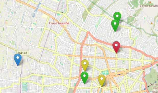
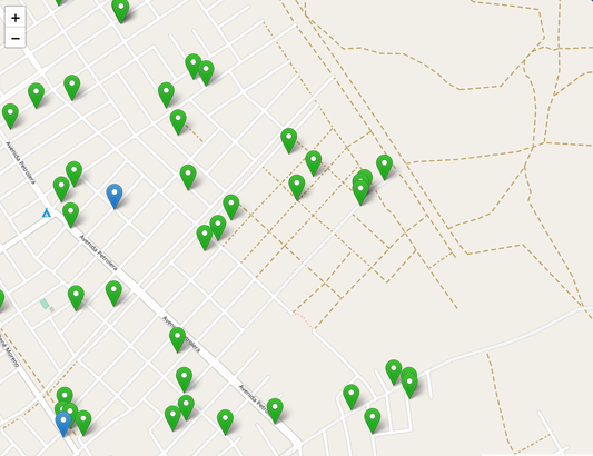
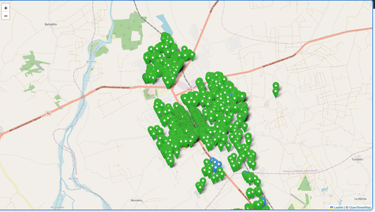
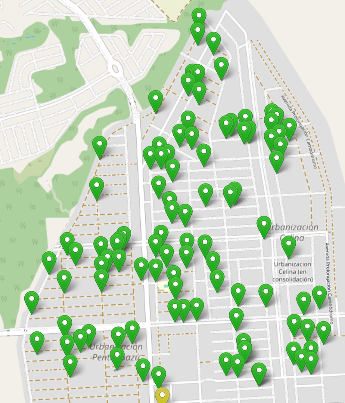
Color-Coded Map Display
Scan QR codes with any smartphone to capture asset data
-

Installation and Maintenance Records
Leverage asset data to optimize operations and plan for the future
-
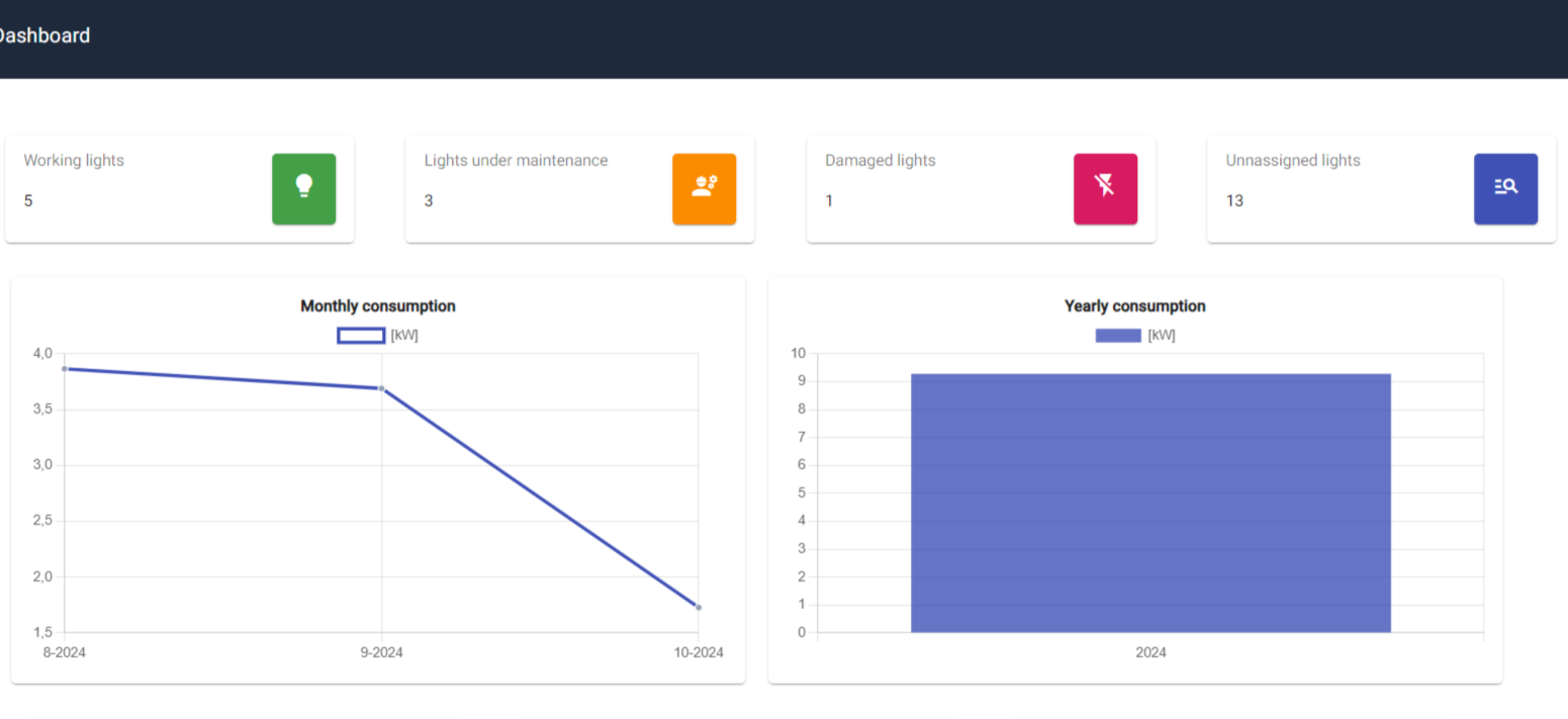
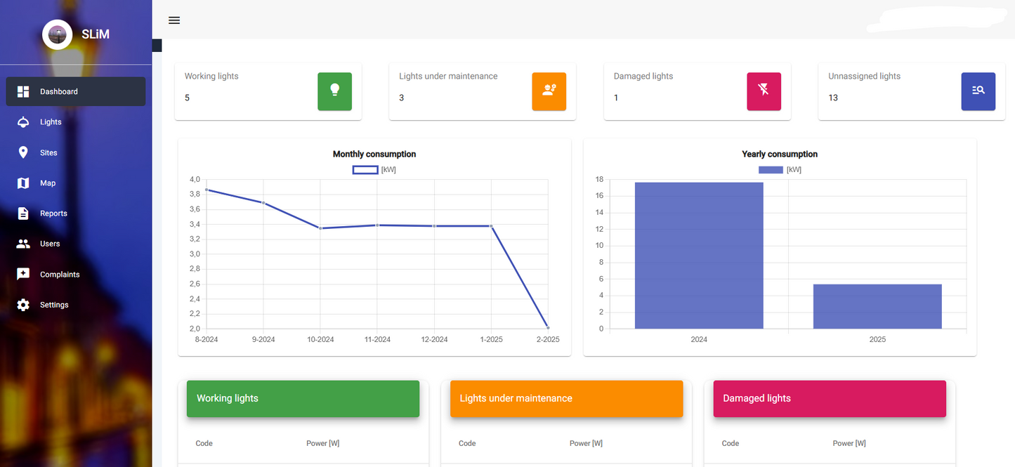
Maintenance Reports and Consumption Tracking
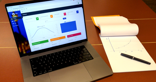
Access asset data, maintenance records, and performance metrics in one place


Featured Products
-
Free Trial
Regular price $0.00 USDRegular priceUnit price per$0.00 USDSale price $0.00 USD -
GeoTagIQ Starter Kit Max 100 QR tags: 1-Year Subscription
Regular price $149.00 USDRegular priceUnit price per -
GeoTagIQ Pro Kit: 1-Year Subscription with 500 QR tags
Regular price $499.00 USDRegular priceUnit price per -
GeoTagIQ Enterprise Kit: 1-Year Subscription with 1000 QR tags
Regular price $899.00 USDRegular priceUnit price per